




Keyhole Radio

Perihal Keyhole Radio
A CLOUDRF.COM ACCOUNT IS REQUIRED. FREE PLANS AVAILABLE.
Radio Engineering software for RF Engineers on the go.
See where your radio or repeater can communicate to with the Android app from CloudRF.com.
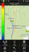
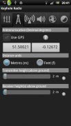
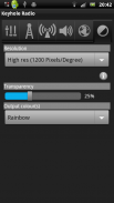
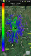
TO USE: Pan the map to zoom to your transmit site then press your menu or keypad center buttons to access the 'calculate' form. Enter your device's parameters and click the big orange button to create your coverage. Settings and help are available in the app's menu.
Full user manual available in app menu or at <a href="https://www.google.com/url?q=https://www.google.com/url?q%3Dhttps://keyhole.cloudrf.com/app/keyholeradio.html%26sa%3DD%26usg%3DAFQjCNEKLEqgfr8xZa0Wq7zCQJbs5EJI8w&sa=D&usg=AFQjCNGLtmHW6QpVvN2QqxbfsoSaaG0YkQ" target="_blank">https://keyhole.cloudrf.com/app/keyholeradio.html</a>
A CLOUDRF.COM ACCOUNT IS REQUIRED. FREE PLANS AVAILABLE.
Requirements:
* Internet connection - to communicate with server.
* GPS - to locate your position for mobile users (opt in)
Supported systems:
* Wifi, 802.11 (2.4 / 5.8GHz), TETRA, PMR, LMR, VHF, UHF, SHF, PTT, GSM, 2G/3G/LTE, DAB, DVB
Support: <a href="mailto:support@cloudrf.com">support@cloudrf.com</a>
App Features:
Transmitter
Frequency range 20 - 100,000 MHz
Effective Radiated Power 0.01 to 500,000,000 W
Coverage radius 0.1 to 100 km
Geo-location
Decimal degrees
Altitude (Above ground) 0.1 to 60,000 metres
Antenna
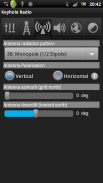
Radiation templates
8 templates in .ant v3 format
3D radiation patterns vertical and horizontal
Polarisation - Horizontal or Vertical
Azimuth and Down-tilt
Receiver(s)
Height above ground
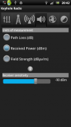
Received power mode (dBm)
Path loss mode (dB)
Field strength mode (dBuV/m)
IRREGULAR TERRAIN MODEL
LINE OF SIGHT
OKUMURA HATA
COST231-HATA
FREE SPACE PATH LOSS
Environment
Average ground clutter height
Custom KML clutter toggle
Terrain conductivity selection
Atmospheric climate selection
Output
Terrain Resolution (30m, 90m, 180m)
Average ground clutter height
Custom KML clutter toggle
KML clutter upload
Colour key choice


